On the E1 in Lüneburger Heath just south of Hamburg
Wellness blogger Tanja Klindworth is convinced: “the European long distance hiking trail E1 leads through Germany, through probably the most beautiful scenic regions that our country has to offer” – one of these is Lüneburger Heath in the north of Germany. The author of Wellness-Bummler and Spaness – business meets paradise – is reporting for us from out on the track. She focused in on one part of the roughly 100-kilometre leg of the E1, which leads through the Heath region, using her aptitude for picking out photo opportunities. As a hiker, you get to see most of the Heath region by travelling between Undeloh and Soltau. “The landscape in the region around Wilseder Berg is particularly beautiful, with the small museum town of Wilsede, the Steingrund and the Totengrund valley,” recommends the author. You can read about everything else Tanja Klindworth liked about her hike in her blog post.
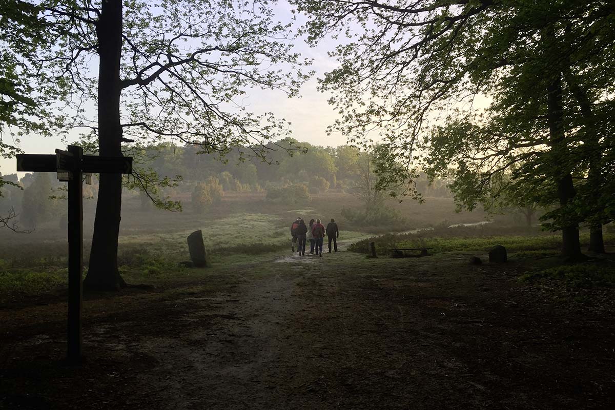
A tip before we start: if you want to capture particularly beautiful pictures, you should set off on your hike through the region at sunrise.
Kicking off the Heath leg of the E1 with a sunrise
The striking landscape of Lüneburger Heath, with its gently rolling hills, lay ahead of us as we set off on our hike very early in the morning. The first leg leads through a wooded area. It suddenly lightened up a lot as we emerged from the protection of the forest into a landscape typical of the Heath region, filled with juniper bushes, short shrubs and heather. A thin layer of fog loomed over the heathland. Spider webs had caught the morning dew and the sun was trying to fight its way through, already starting to peek through here and there, bathing us in the day’s first warming light.
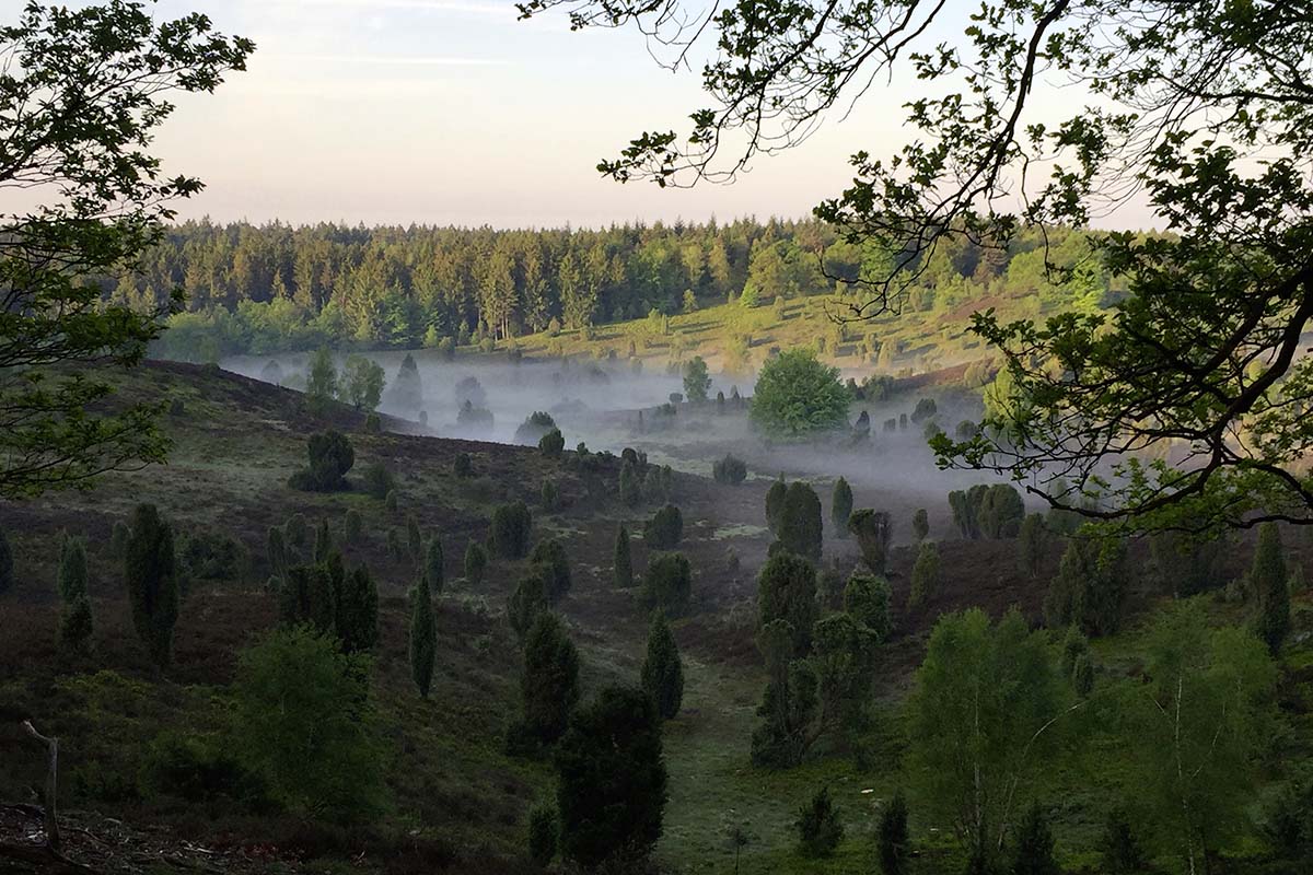
E1 – Highlights of the Heath: from Wilseder Berg to Totengrund
We were in absolute awe of the trails that led us over the characteristically sandy track, lined with heathland and juniper bushes, to a small hill. Once on the hill, we were rewarded with a phenomenal view out over the Totengrund valley. One of the first nature conservation areas in the Lüneburger heath was established in this dry valley with its morbid name. There are several theories regarding where it got its name from: one claims that in prehistoric times it was the route of funeral processions for burying the dead. Another theory assumes that the whimsical valley was formed by a former ice block (as a glacier retreated). It is also a possibility that it is a result of a meteorite impact. Although, the last theory could well be the correct one. It claims that the inhabitants of Totengrund could not grow or farm anything due to a lack of nutrients and water in the soil – hence the name “Toter Grund” or ‘dead ground’.
The valley gave an impression that was completely opposite to that of being ‘dead’. We enjoyed the weather, the lively nature and a pleasant hike that followed the edge of the slope, leading down into the valley and to the opposite side from where we were once again able to enjoy a breath-taking view. We rewarded ourselves here with another short break: hiking shoes on our feet, the first few kilometres already behind us, a bench with views directly into nature, sunshine, a cheese sandwich and hot coffee – what else do you need to be happy?
Out and about on the E1: from Totengrund to Behringen
It was still early on in the day, so we really took our time for the remainder of the track. We left the gently rolling hills of the Heath landscape and disappear once again into the forest. The sun was shining in the sky and its rays of light were fighting their way through the thick forest canopy. Light, shadows, leaves and chirping birds all made for a very special atmosphere in the Friedwald. The Friedwald near Behringen is not only a very beautiful area of mixed woodland with maple trees, birch trees, beech trees and other deciduous trees, but also serves as a final resting place. People are buried directly by the roots of the trees. The final resting places are marked by wooden signs, irregular boulders and small number plates.
We left the Friedwald and continue hiking towards Behringen. The track leads right past a group of burial mounds. We took the time to walk the small loop containing 27 burial mounds and various information panels.
We stopped off in Behringen for breakfast – by then we had really earnt it! There are various options as to where you can choose to make a stop (e.g. the Akzent Hotel zur grünen Eiche right as you enter the village or even the Albers’ Rosenhof at the end of the village).
The final push on the Heath leg of the E1: from Behringen to Bispingen
Completely refuelled with energy, we continued our hike towards our goal for today – another roughly 10 kilometres lay before us. Step by step, through small sections of forest, through meadows and fields, past the tiny little village of Steinkenhöfen all the way to the small town of Bispingen. It’s worth visiting the ‘Ole Kerk’ in Bispingen, an old church built from fieldstones dating back to the 14th century. During the summer months, the church is open daily from 10 am until 6 pm. Anyone that has any questions about the region or is maybe still looking for accommodation can just swing by the Bispingen Tourismus e.V., the tourist information centre.
All pictures in this post ©Tanja Klindworth; spaness.de